Pushing to the edge is something that I really enjoy about ultrarunning. Stepping into the unknown knowing that at some point it is going to get hard, very hard, and all you have is your training and your grit to get you to the finish. Leaning into this kind of struggle is a skill that I have learned over many years. I was not always this way; I have shaped an appreciation for discomfort over time. It is the only way I have found to get better at anything. As a runner, as an entrepreneur, as a husband.
With the race season canceled for the year due to COVID, I was itching to test the fitness I had built back after my second hernia surgery in as many years.
I felt really good, and I needed a carrot to put on the end of the stick.
I had wanted to hike the Lost Coast long before I became an ultrarunner. In my days as an ultralight long-distance hiker, if you cant tell, I gravitate to things that are ultra; I had learned of the Lost Coast by reading an article by Ryan Jordan on BackpackingLight.com back in 2004. I figured I would end up doing it as a two-day fastpack one of these days. Then came the rise of the FKT (fastest know time). As I said, with races canceled, many members of the ultra clan had begun setting FKTs on established routes and creating first known times on new routes starting in April when things started shutting down. As I said, I was itching for a chance to dip into the well and started looking at a few routes around Northern California. When I came across Ricky Gates and Leor Pantilat’s unsupported time of 13 hours 47minutes on the Lost Coast after reading their trip report to learn that these ultra studs had done this at a “pedestrian pace,” I thought maybe just maybe. On paper, it seemed doable 57 miles with just under 10k of elevation gain on a mix of beach running and steep single track. I could treat this route as a race, and if the cards lined up and the chips fell right into place, maybe I could squeak in a new FKT. The gears were turning, and I began the process of planning for this new goal.
The Morning Calm
My alarm woke me at three am on the morning of August 22nd 2020, and I began the rituals that would inevitably find me starting my journey. Quietly I exited the tent, rolled out my sheepskin, and settled into my morning meditation, which I have been doing every morning without fail for the last 6+ years, quieting the mind like the calm before the storm that was coming. The sky dark, the stars endless, and the sound of the waves crashing on the beach a few hundred yards away, a rhythmic washing of sound as I settle into my practice. From my first inhale, I knew that today was going to be a good day. I made my usual breakfast toasted sourdough with coconut oil and salt and a half an avocado with hemp seeds kind of a deconstructed avo toast. I sat back to enjoy some black french pressed coffee with a tablespoon of coconut oil melted in it. It was about an hour till the start time. Sipping my coffee, looking up at the stars, listening to the waves crash on the distant shore, I thought about everything that had gone into preparing for this. The hours of research pouring over google earth and various websites, the gear testing during my long training runs, I felt as ready as possible. I had prepared my gear and clothes the night before staging everything in the truck’s front seat. I grabbed my nutrition from the cooler and began to dress and gear up.
If you are familiar with my nutrition strategy, you know that I tend to make most of my calories using whole food ingredients. Today I would have four bottles worth of my Chia Fresca mix, 2 in Amphipod handhelds, and another two in what I like to call a chia fuel cell. It is two bottles worth concentrated into one 500 ml soft bottle that I can split into the handhelds then topped off with water once I run through the first two bottles.
Each bottle is four tablespoons chia seed, four tablespoons maple syrup, and one fresh squeezed lime with a 1/2 tsp of pink sea salt. Each chia bottle needs to soak overnight and is about 500 cal.
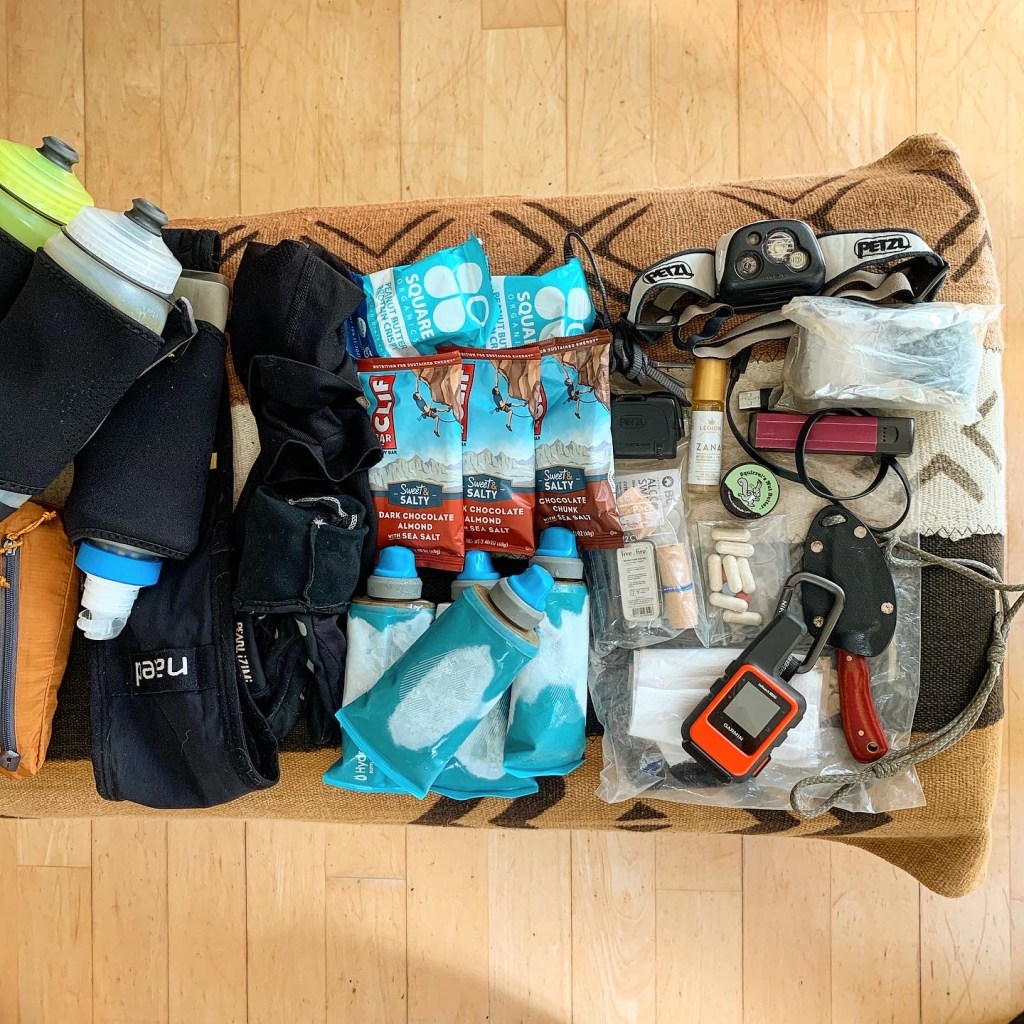
I also had three 150ml soft flasks of a homemade spring energy concoction of turmeric basmati rice, peanut butter, dates, honey water, melted coconut oil and pink sea salt. Each flask is about 550 cal. I also carried three cliff bars and a couple of manuka honey and chocolate single-serve squeeze packs with green tea extract for a little caffeine boost, several Gu electrolyte capsules, 6 Chilli Mango Glowing Buddha 10mg THC Gummies in a mini ziplock, and a bag of sea salt kettle chips. All told, I had around 4,800 calories carried.
To round out my 4L Patagonia Sloperunner vest and Naked Belt, here is my gear list:
Two 500ml soft bottles for water One 500ml soft bottle with a befree filter for filtering water
- Two 500ml soft bottles for water One 500ml soft bottle with a befree filter for filtering water
- Small fixed blade knife
- Small blister kit in a ziplock bag
- Space blanket
- Houdini windbreaker
- Headlamp with an extra battery
- Small Goal Zero Battery Bank
- Cables for charging my Suunto Spartan Ultra GPS watch, Iphone 6s, and Garmin Inreach Mini
- Small Montbell trowel and TP for when nature called
- Iphone 6S (what can I say I’m old school:))
- Garmin Inreach Mini
With water bottles filled, my pack weighed in at around 8-9lb fully loaded.
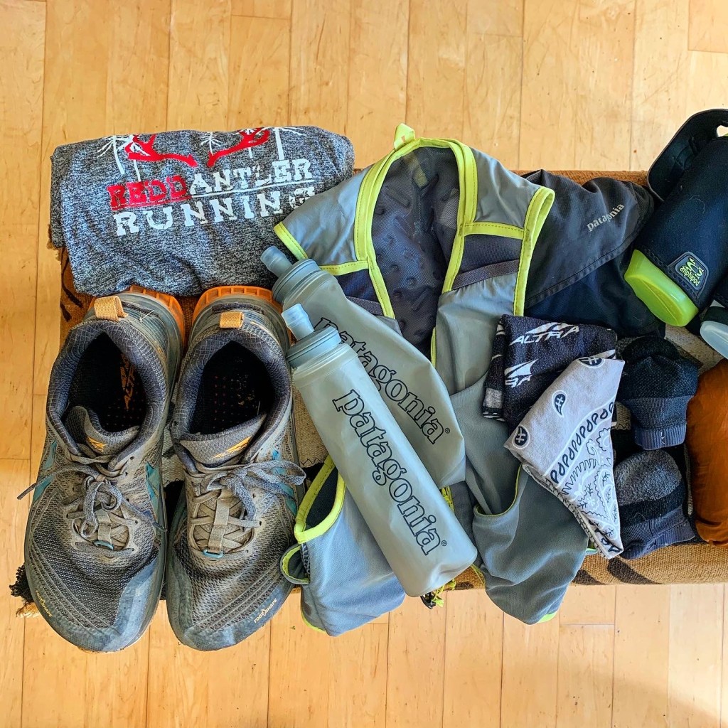
Suited up, I laced up my Altra Temp 1.5’s I rechecked that I had everything I needed and began the short walk to the trailhead.
The Unforeseen Meat Grinder
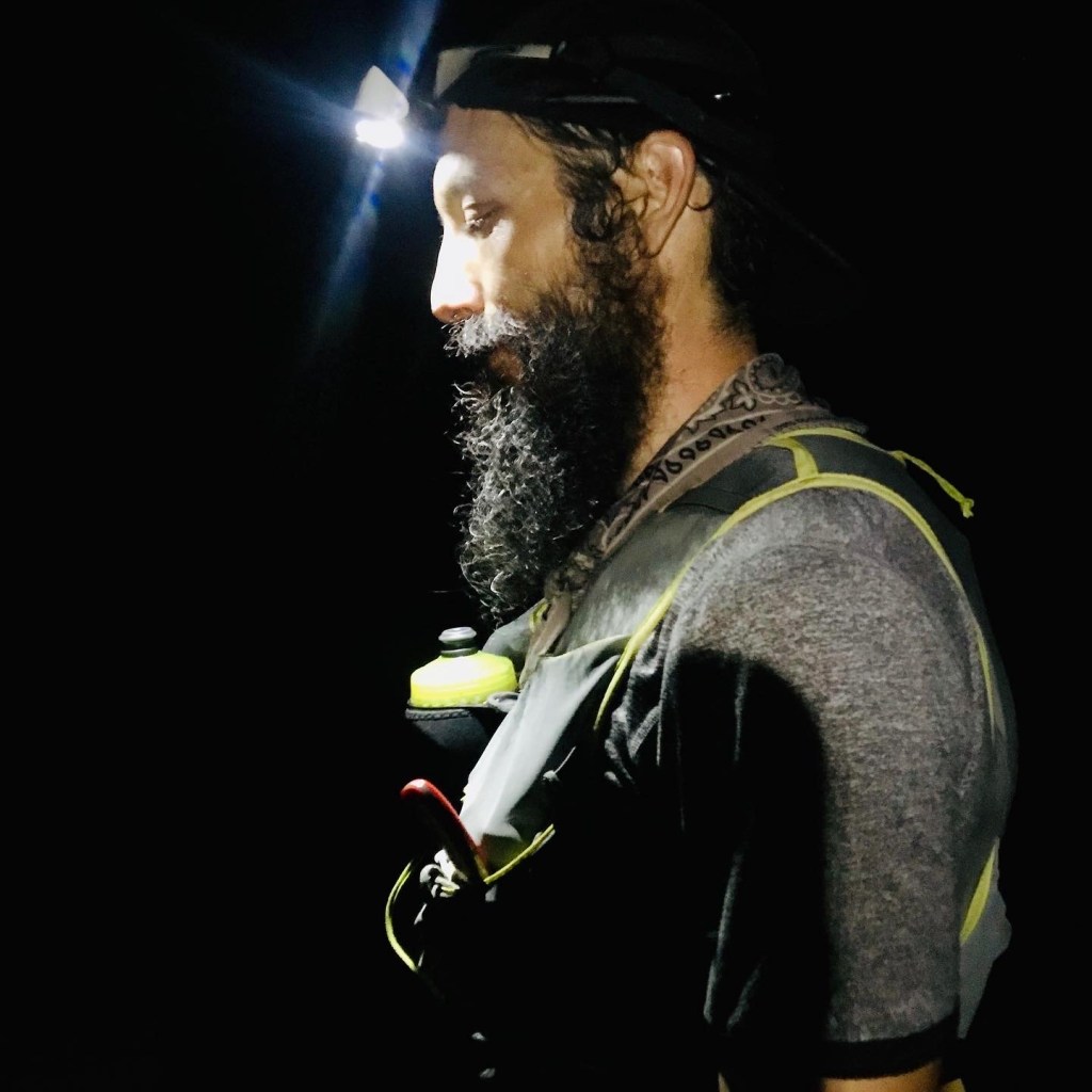
My journey began at 5:11 AM by activating the tracking on my Inreach mini so that people could follow along on my day and starting and taking a pic of my Suunto Spartan Ultra watch.
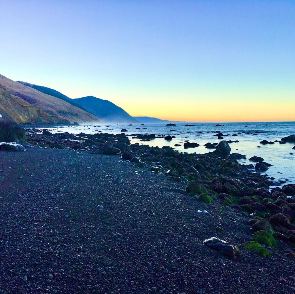
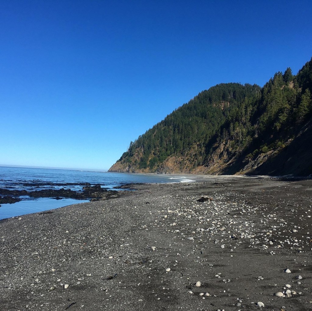
The first hour and a half, I ran via headlamp. The trail was a combination of sand and hard pack. I knew from scouring google earth that there were several sections where you could leave the beach and get onto a solid hardpack trail. I knew that missing any of these opportunities would add time and difficulty to my day. It was one of the things that I was most concerned about for the Lost Coast beach section. The other thing that I was slightly worried about was making sure that I timed getting to the three areas impassable during high tide right.
Low tide was going to happen at 8:09 that morning. I was hoping that by starting at 5 AM, the first impassable section at Punta Gorda, the tide would be low enough to pass. After passing the Lighthouse in the pre twilight before dawn, there was just enough daylight to navigate without my headlamp when I got to the point. It turned out that the tide was just low enough to get past. However, it required that I scramble on large wet slippery boulders with crabs scampering away as I hurriedly tried to pass this section without slipping and falling or have my foot slide into a crevasse or roll my ankles. Once around the point, it was nice several smooth miles on hard wet sand, and I got into a serious groove.
The tide would continue to fall back as I moved into the second impassable section from Sea Lion Gulch to Randall Creek. In this 4 mile section, there were a few stretches of rock hopping, but for the most part, it was smooth running on compact wet sand, and I stayed in the groove.

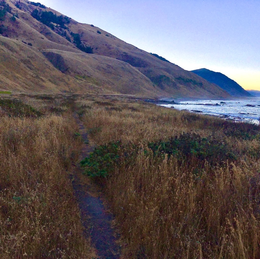
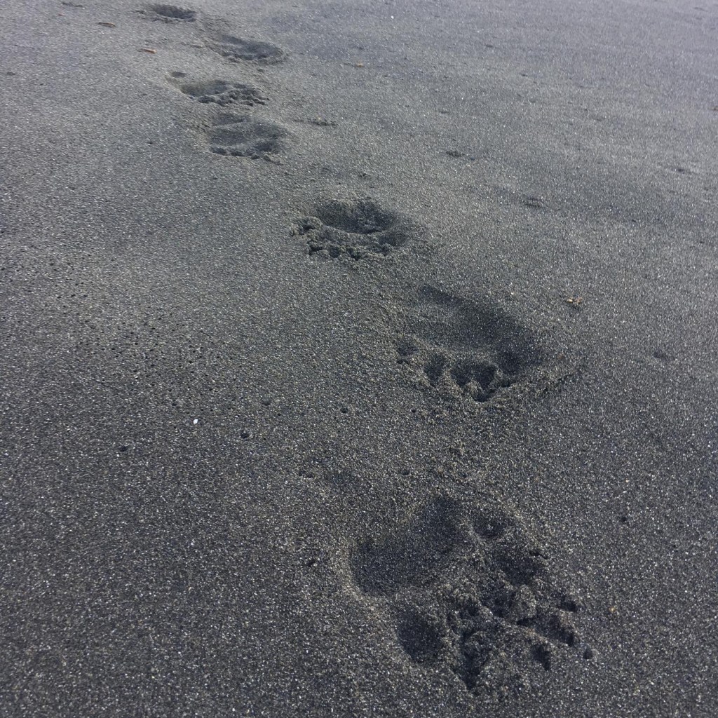
Not realizing that I had reached Randall creek, I blew past the dry land opportunity onto the Spanish Flat trail. It did not take me long to realize my mistake, and after maybe a quarter mile, I turned back for the creek. I should have known better as several tents were set up where Randall Creek dumped onto the beach. I tiptoed through the tents as campers were beginning to stir and quickly found the trail leading up to Spanish Flat. The trail here climbs a little bit before weaving its way across the flat plateau above the beach, and I settled into a good pace and soaked in the morning and the views as the miles melted away. I passed a few cabins and creek crossings and saw a hunter up further up the plateau. I heard his rifle go off before I saw him as I approached Spanish Creek but could not see what he was shooting at up the ridge. He never saw me as he headed up toward the direction he had fired, and I continued across the creek to continue my journey. As the flats ended and I was dumped back down on the beach, I came across a line of bear tracks pressed into the sand headed toward me and continuing down the coast. The prints were rather large and looked fresh; I wondered how long it had been since the bear had passed.
After running on the beach for a few more miles and passing Big Flat, I started into the last impassable high tide section right at 9 AM, and I thought, “I could not have time this more perfectly.” This is the first time I would see hikers on the beach loaded down with their cumbersome packs starting their journeys to make it past this 4 mile section during low tide. After a few hundred yards of rock hopping, I passed a group of hikers that I know had that “look at this crazy guy” look on their faces as I passed them smoothly, picking my way across the boulders. With their heavy packs, they struggled to keep their balance in this technical section of the beach. After that stretch of rock covered beach, the rest of the run was mostly on wet packed down sand, and I was able to keep a steady pace.
In the section between Big Flat and Gitchell Creek, I saw a bald eagle perched high in a tree on the cliff over the beach and a group of sea lions sunning on some exposed rocks 20-30 ft offshore.
Gitchell Creek would be my first water stop, and I refilled my bottles and tanked up. I also took this time to fill one of my handhelds with half of my chia fuel cell and top off that bottle with water. I wet the bandanna around my neck and the buff around my wrist. The cold water felt perfect as the heat of the day was starting to set in.
I realized here that a litter fill bottle for my filter would have sped up filling my bottles as I would have to fill up the 500ml bottle twice to fill up one of my vest bottles. After Gitchell Creek, there were only a few more miles of beach running until I got to Black Sands Beach and Shelter cove. It had taken me a little over five and a half hours to get from Mattole to Shelter Cove. This being 30min slower than my goal time, but I thought to myself, not too bad. I sent a message to Natalie back at Mattole using my Inreach to let her know that I was a little behind schedule but still on track for the FKT and feeling good. There is a small patch of beach at Mattole where she could get service, and we agreed the night before that I would check in with her when I got to shelter cove. I climbed up to the parking lot and started the climb up Shelter Cove Rd that would ultimately get me to the summit of Chamise Mountain.
The Grind
I cannot express how steep this road is in the first few miles!! I quickly realized how much the beach had chewed up my legs, and it took me quite some time to get my climbing gear back. I ended up walking most of the climb out of Shelter Cove, a little frustrated because I knew that I should be running large portions of this section. The road was exposed in many places, and the day’s heat started to get to me. There was also a detour that added at least a mile to the route because of road work on Shelter Cove Rd. I was a little discouraged by the setback but managed to run/walk the last few miles of the 5+mile climb, and finally made it to the Hidden Valley trailhead and the Sinkyone Wilderness section of the Lost Coast.
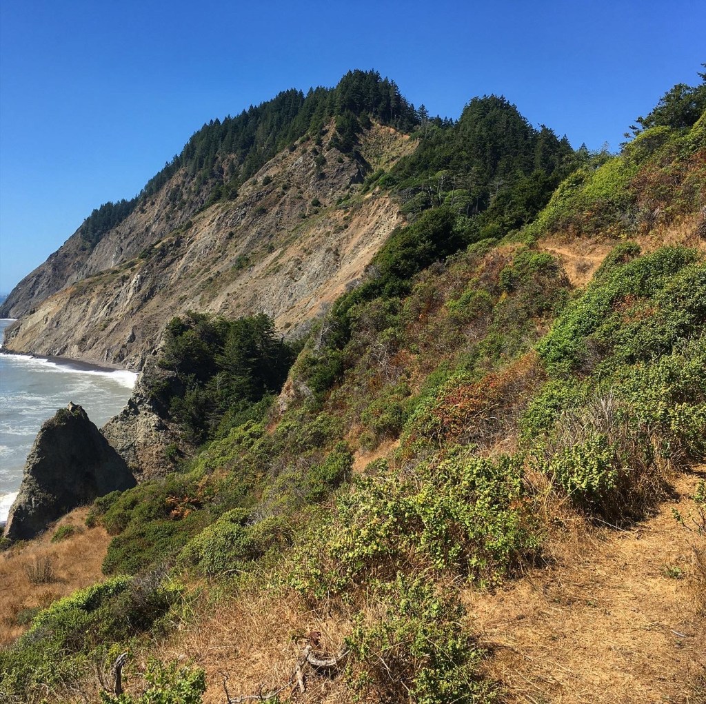
I filled my chest bottles and filled my second bottle of chia fresca from my chia fuel cell, wet my neck bandanna and arm buff, and set off. There is a little bit of climbing left to reach the summit, and the US Geological Survey marker was a welcome sight. At this point, I found my legs again and started the 3000+ft quad searing decent to Needle Rock. Most of the Sinkyone Wilderness section is in tree cover, switchbacking its way up and down steep coastal valleys to various creek crossings. The trail is narrow, unmarked, and in some places, little more than a glorified game trail. It is overgrown in many places with lots of deadfalls crossing the trail and covered with poison oak. The closer you get to Usal Beach, the more it feels like bushwhacking and less like trail running.
After a steep 5 mile descent, the trail levels off into a nice runnable rolling 7 mile section that had me in a good groove and moving strong.
Needle Rock comes into view around 3 miles into this section as you continue on to Bear Harbor. I found myself cruising along really well and thinking that I may just squeak in under the current time. Once you get to Bear Harbor, the Real fun begins with only about 3500 ft of the 10,000 feet of climbing completed, a series of dragon teeth ascents and descents punctuate the later part of this route. With 15ish miles to go and over 6000 ft of climbing left, I knew that it was going to get interesting fast. I still felt good leading into this first climb, but that would soon change. The last 15 miles from Bear Harbor to Usal is switchback city. It requires lots of hand on knees power hiking going up on very steep narrow trail and meticulous foot placement on the downs. The descents are just as steep as the ups, which makes for a snail’s pace. Hoping that I would be able to make up time on the downhills was just not going to happen, and after the first climb, my pace began to slow as the wheels started to fall off slowly. I messaged Natalie that I was slowing down and that I would likely miss the FKT but should still make it before our set cutoff time of 15 hours elapsed time.
The dog encounter
I can’t quite remember exactly where I ran into the beast. I believe that it was somewhere between Bear Harbor and Wheeler Camp. I remember getting to the top of a climb when I heard him start barking at me. I froze and started scanning in the direction of the bark. About 20ft from me, under a stand of scrub oak in front of me and to the left was an 80-90lb male german shepherd mix butt up front legs extended in a crouch barking. I stayed still and casually placed my hand on the knife that I carried reading to draw it if he made a move for me. I could not see his tail and had difficulty determining if this was a warning bark or a let’s play bark. After what seemed like a minute or two, he stopped barking for a second and thinking that he could belong to some campers down the other side of the hill, I called out, “Does someone want to come get their dog?!” No one answered, and then he started barking again.
Now I have dealt with several dogs in my running days, and there is one trick that I have used that almost always works to get a dog to leave you alone. I looked him dead in the eyes, and in a commanding voice, I told him, “GO HOME!!” Like clockwork, he stopped barking, put his tail between his legs, turned, and started back the way he came. I followed him, keeping my distance for a second, not realizing that he went down a side trail, then I noticed the back door to a cabin that looked to be built right into the hillside. After watching him go into the open door, I turned and found my way back onto the main trail, not 15 ft away. I breathed a sigh of relief and thought to myself that was close and that I would love to own that cabin!
Continuing on my way, I continued to push up and down the valleys. With less than 10 miles to go, I knew that getting to the finish would likely turn into a serious suffer-fest. There were several sections with hundreds of yards of trail overgrown with this large grass-like plant that was several feet long. It would grow up over my head and drop down into the path. The blades were about two inches wide; as I stepped on them, they would get forced down, slicing like paper cuts into my knees and legs. I could barely see a few feet in front of me in these stretches. I thought for sure I would round a corner into a Bear or an Elk as I had seen scat for these animals on the trail.
Climbing out of Wheeler Camp, the sun was starting to set as I moved into the tree line, I pulled out my headlamp, the light fading in the thick campy, and prepared myself for a long night. I was still hiking well, but my pace had slowed, and I knew that it would be several more hours before I would end up at Usal.
Running into the Guardian of the Forest
I was making the descent into Little Jack Ass Camp with just enough light from the last bit of dusk to make out the campers’ faces getting a fire going and settled into their new home for the night. Announcing myself letting them know that I was just here to filter water from the creek, and I would be on my way in a few minutes. With my bottles topped off, I started hiking up out of the valley. After the second switchback, I turned to look back down at the campsite, maybe 40 ft below me, and that is when I saw its head turn. Standing maybe 15ft from me down off to the side of the trail behind a tree, the rack of a massive Bull Roosevelt Elk turned to meet my headlamp’s beam. I was in awe; I could see his enormous silhouette as we locked eyes for a moment. Instantly, his face turned whimsically into that of the Guardian of the Forest from the Miyazaki film Princess Monaniki. I felt a rush wash over me as I knew that I was right where I needed to be. I turned my head to continue up the third switchback. He went back to looking down at the camp below as I climbed up the valley. I chuckled to myself, thinking about what I had just seen. The forest’s most giant animal was waiting patiently behind a tree, curiously waiting for the right opportunity to go down to the creek for a drink. I found myself thinking about the dialogue that must have been playing out inside his head. “Is now a good time?” “Maybe I will just wait until they go to sleep before I head down there.” Then I thought, well, I hope he does not come back this way.
The Last Push
With one last climb to go, I descended into Anderson camp, where I came upon a group of three young men listening to classic rock and drinking beers by the campfire. It had grown very dark in the thick canopy of trees, and the music was a welcome reminder that I was not all that isolated out here. Like before, I announced myself and let them know that I was just here to grab a little water and be on my way in a few minutes. These guys were surprised to see anyone out this late and were interested in what I was doing. I asked them how far to Usal, and they said that it was 5miles away. This distance had me slightly discouraged because I hoped it was a little closer than that based on the 54 miles my watch shown I had already traveled. One of the guys asked, “Where did you come from?” When I told them that I had left from Mattole at 5 AM that morning, the looks on their faces was priceless. The same guy proceeded to try to show me a short cut on his GIA ap that he said would take off a few miles. I let him know that I had a specific route that I was on an that another hour or two on the trail was not a big deal. At that point, I took the time to refill both of my bottles so that I had plenty of water since I had a feeling that with this last big climb to go, it would be closer to 2 more hours on the trail. Those guys were great! I could tell that they were willing to give me anything that they had to make the rest of my journey more comfortable. I thanked them for the hospitality and continued up the switchbacks out of the valley. I could hear one of them say, “I am gonna put on something for this guy.” As I climbed, I could hear the sound fo Bad Company’s – “Don’t you know that you are a Shooting Star” begin to play on the speaker. They turned the volume up, and as my headlamp was getting out of view several hundred feet above their camp, the chorus broke out through the darkness. They gave out a big hoot, I hooted back, and the music faded into the distance as I keep climbing. Sometimes it’s the little things that make the difference, and these guys helped make the last 5 miles go by a little easier. The final climb out of the trees was serious work. I was hiking well but had stopped eating calories, and my pace had slowed in the dark. I had tunnel vision focusing on putting one foot in front of the other I was not quite in death march mode, but the day’s fatigue was settling in. That’s when I stepped off the trail in a weird spot. I pushed through two branches that were stretched over the path and stepped forward. I took a few more steps, pushed pass another mass of limbs, stepped over some deadfall, and then stopped. The trail was gone. I was surrounded by trees and branches in a small ravine with what looked like tiny game trails moving in several directions down the hillside through the thick brush and trees. I looked to my left and right, no clear path. I looked at my watch at the route that I had uploaded from the FKT site; sure enough, I was off course. I turned left, then right, looking at my watch to see what direction the trail was. In the thick canopy of the dense forest, the signal was spotty; the positioning would turn slightly but not enough to tell me for sure what direction I needed to go. I took a deep breath and collected myself. I was 55+ miles deep, had been on my feet for over 16 hours at that point, and was not about to spend the night lost in the woods. I exhaled and took stock of what I knew. I was at most 15, maybe 20 ft off the trail, and from what I could tell, it should be behind me. I looked around and familiarized myself with what was right next to me to start a search grid and, if needed, to find my way back to where I started. Turning around and looking up to scan in the direction that I thought I had just come from, I could see what looked like a level plain moving left to right about 15-20 ft up the hill above me. I scrambled up, and sure as day, it was the trail. I stood there for a second and then realized what had happened as I pushed through the first set of branches, I went straight, but the trail went left. I had lost focus for a second, and in the dark, it was easy to miss. I told myself to tighten up; you are to close to let your mind slip.
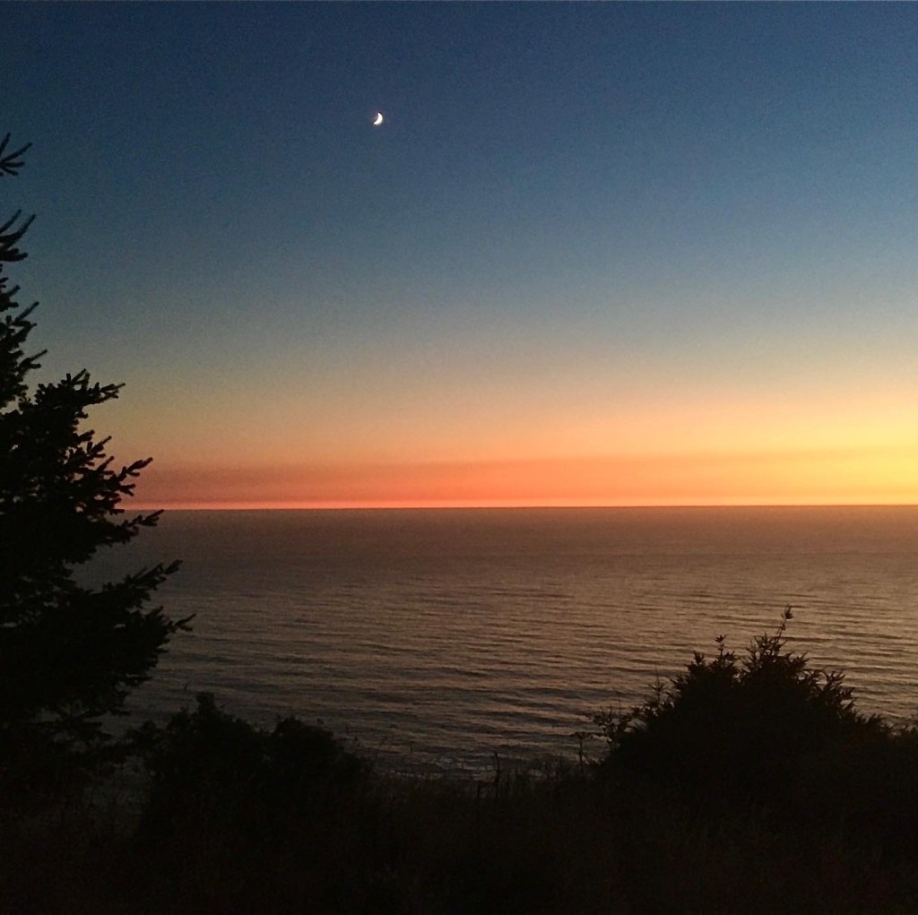
Happy to be back on the right track, I finished the climb’s last stretch as the trail opened up to grassland on the cliff sides above the ocean. The trail here crosses up and down the cliffside, narrow and covered in brush with short but steep sections that seem to cut back on itself in many places. The sky was clear; the crescent moon was rising into the sky, the stars were starting to come out, and there was a vivid deep red, pink line of color on the horizon. Breathtaking is an understatement. Then the booming of fireworks and gunshots could be heard far off in the direction of Usal Breach. I even saw what I believe was a military flare shot into the sky as a ball of white light hung over the ocean in the distance for several minutes before twinking and fading out. I wondered what kind of shenanigans was happening on the beach.
I knew the end was close; I could see lines of lights from the cars parked on the beach in the valley below. The last 2 miles were still relatively slow-moving until the final descent took me back into the trees for a series of steep switchbacks to the trailhead. Natalie met me a few hundred feet up the trail. She had a look of relief in her eyes when she realized that it had been my headlamp that she had seen weaving down the path. At that point, she had been waiting for me for several hours, wondering if I was okay since there was no service at Usal. I trotted into the parking lot and stopped my watch 17:34:31, elapsed time finishing at around 10:45 PM.
You can check out my run data here on STRAVA
The Days After
The struggle bus was real for several days after this one. The Lost Coast Trail is a legit meat grinder. It took several days for the body to like stairs, and about a week before I even thought that trying to run was a good idea. Even then, it took another week for the body to feel ready to start putting in some training again. I was in relatively good shape going into this one, and the route exposed all of my weaknesses.
The mental tax with unsupported FKT’s is real, pushing yourself for that long with no support, no aid stations, no other runners to use for motivation, you have to have real grit to keep grinding when the lows come. But I will say that was the best part of the experience. It was just me on a route that I had never done before leaning into the unknown, and I loved every second of it.
If you are interested in running the Lost Coast, here are a few links that I found very helpful in planning my trip.
For timing the tide in the northern section – Tide Predictions
For a detailed write up of the Northern Section
For scoping out the Southern Section
For a GPX file for the North to South Route, visit the Fastest Known Time Website.
If you have any questions on the route, feel free to comment below or reach out in the contact section.
You can follow my Journey on Instagram @high_country_guides

Troy, what an experience! I can only imagine the beauty you saw. I followed you until Jack Ass Creek. I was exhausted. Lol. You should be very proud of this accomplishment. I am very proud of your endurance and drive. I am so happy that you documented your adventure and shared with those of us that will never run, hike, or walk these trails.
LikeLiked by 1 person
Thanks for following along and for all the support! I was exhausted at Jack Ass Creak too:)
LikeLike
Wow son what an adventure! You have done something that few people on earth have done. So proud of you. You inter strength is just amazing. Love you Dad
LikeLiked by 1 person
You are 100% and inspiration my friend as you I am also part of the cannabis community and have been my entire life this past year I took it upon myself change everything. The way I thought the way at eight the way I lived everything and through that I found ultra running. I’m just getting started and loving every minute. I did my first unsupported ultra on Monday. 35 + miles what an amazing experience and it totally hooked me. I look forward to what I can accomplish in the ultra world it’s an absolutely amazing feeling being able to push yourself to those places most will never understand. Get after it my friend Cheers!!!!
LikeLike
Welcome to the Tribe Graham!Congrats on finishing your first Ultra Distance run!!!
You have to sign up for a 50k now and get the full-on Ultra Tribe experience.
I am actually gonna be heading back to the Lost Coast this Sunday for some redemption on the route chasing the Unsupported FKT. I will have tracking available check the link on the site under live tracking.
LikeLike
Hey son good luck Sunday. Please send your old man the tracking link. So Carol and I can follow you.
Love you
Dad
Sent from my iPhone Steve Meadows
>
LikeLike